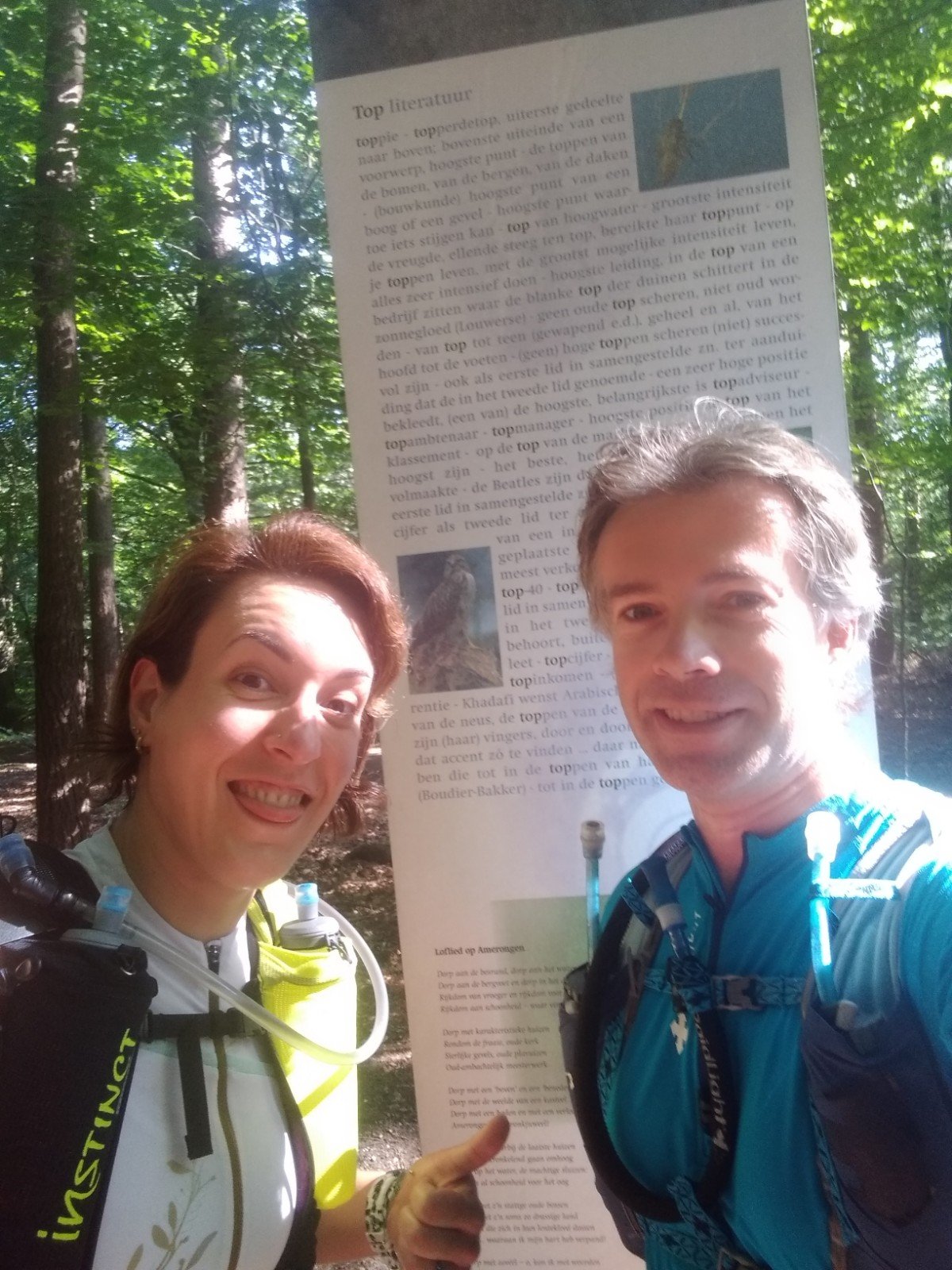
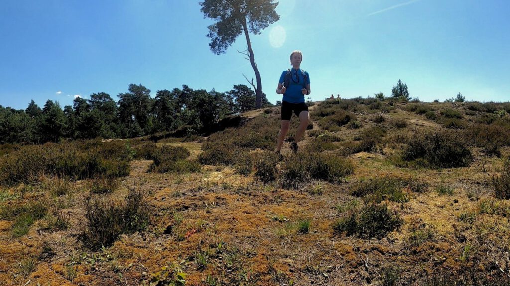
Together with Simone I started the last of the virtual challenges of MST: all 14 hilltops of the Utrechtse Heuvelrug in one ultratrail. How would we endure without specific race training?
A while ago I did several virtual challenges from Mud Sweat Trails, including one with a water crossing, a 30 km before sunrise and a vertical kilometer. The final challenge is the UH14and it needed a little additional planning. Especially because the government's advice on travel and the like was a lot stricter when this challenge was set. The other challenges I had run locally for this reason, but climbing all the peaks of the Utrechtse Heuvelrug means you have to run in that specific area. Luckily this challenge can be done in June and July, so after the government loosened the restrictions, I chose a date together with Simone to run this trail fully self supported.
The idea behind the UH14 is actually that you learn to cope with long runs to prepare for heavy ultra-trails. So it's not so much about the fastest time, but it is meant to get you used to a long challenge by spending a lot of time on feet. That also fitted in well with my preparation for the Indian Summer in October, an 87 km ultratrail in Rolde that I hope to run together with Ramona. For now, this trail will continue – in modified form in terms of starting – so continuing training is important. In any case I have confidence it will not be cancelled and I have even rented an apartment near the start/finish last week.
Nolan’s Fourteen
Again, this challenge is not a pre-cooked route. The idea comes from the Nolan’s Fourteena U.S. mountaineering trip that is used a lot for training and establishing Fastest Known Times (FKT). The idea is that you pass all fourteen peaks higher than 4,267 m in the Sawatch Range in Colorado in a self-designated route. The route will be at least 80 miles long, contains around 27,000 altimeters and must be completed within 60 hours for the challenge.
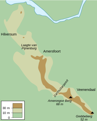
When you hear that, our challenge on the Utrechtse Heuvelrug sounds like it's easy peasy: the course will be at least 50 km, there is no cutoff and the peaks are a laughable 50 m high. At least 13 of the 14 peaks, number 14 is the Laarsenberg, which is just a bit lower, but gives a nice view. The hills are, with coordinates and height (via Wikipedia):
| Name | Coordinates | Height |
|---|---|---|
| Grebbeberg | 51.951775, 5.600894 | 52.0 m |
| Koerheuvel | 51.96445, 5.56391 | 51 m |
| Buurtsche Berg | 51.98944, 5.54861 | 59.9 m |
| Paasheuvel | 51.98167, 5.55056 | 52.9 m |
| Prattenburgse Berg | 51.997753, 5.520603 | 53 m |
| Sparreboomsche Berg | 51.99111, 5.53750 | 54.8 m |
| Elsterberg | 51.99944, 5.50611 | 62.5 m |
| Hazenberg | 52.01035, 5.46849 | 51 m |
| Amerongse Berg | 52.008092, 5.482944 | 69.2 m |
| Vlakke Berg | 52.018828, 5.473525 | 64.5 m |
| Zuilensteinse Berg | 52.0153012, 5.4423515 | 52.2 m |
| Ruiterberg | 52.04041, 5.37787 | 57.9 m |
| Doornse Kaap | 52.04160, 5.36554 | 53 m |
| Laarsenberg | 51.95954, 5.58576 | 48 m |
Remarkable about the list above is that by no means all hills are on Wikipedia's hill overview. If you continue your search in Wikipedia, you'll find some additional information on the missing hills.
In a line
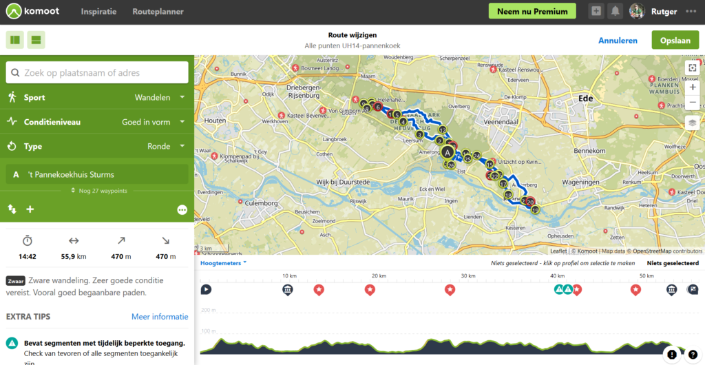
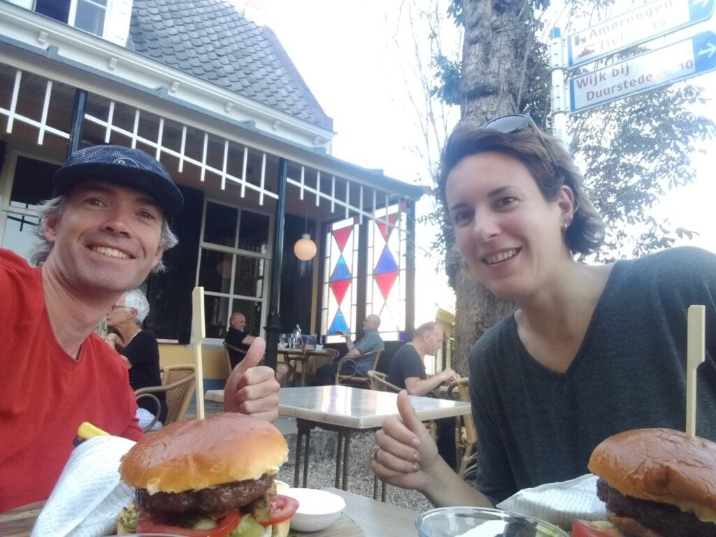
One of the nicest puzzles of this challenge for me was building the route. It had to contain all 14 hills and have a suitable starting point where Simone could park the car. My plan to start from the train station in Rhenen didn't go well. Rhenen was too far from The Hague and can only be reached via small country roads, which takes extra time. My reason for that choice was mainly a precaution: in case of a halfway failure, we could easily get a train or bus to that station. On the other hand: we're both experienced distance runners and a taxi was just a call away. So we opted to park near a pancake restaurant in Amerongen, which would save us some travel time.
Of course in the meantime there were also a number of routes available from others who had ran the UH14. The shortest I believe was around 52 km. But what fun is it using one of those?
In Komoot I first started entering all 14 coordinates. Quite a lot of work, because a typing error is easy to make (MST only had an image). What makes it extra tricky: Komoot's map didn't know all the hills for verification. Some of these tiny hills are apparently not interesting enough to mention either on the map or on the list of hills in Wikipedia. That does not sound promising.
I'm also a big fan of some variation on the route: it's better not to go back and forth on the same path. This is difficult if you want to plan a short route with these requirements, because the hills here are almost in a straight line. That's not very strange, because the ridge of the hills is actually a large moraine that originated in the ice age. Originally the Rhine and Meuse ran in this area and these rivers deposited sediments here that were pushed up by the advancing ice during the ice age into the Utrechtse Heuvelrug that we know today. However, this ridge is rather narrow, which quickly leads to the same route going back and forth. This makes the route not only more boring, but also more difficult to navigate.
In Komoot I used a walking route that had to be walked as a round. In that mode you fill in a starting point (our pancake restaurant) and a destination (random, e.g. one of the outliers of the route). Then you don't add the points in any specific order, but as extra points on the route. This way Komoot places them where it thinks they fit best. This can be on the way there or the way back. This doesn't work very well when starting out with only two points, but at least it provides a little more efficiency than a pre-selected order for the points.
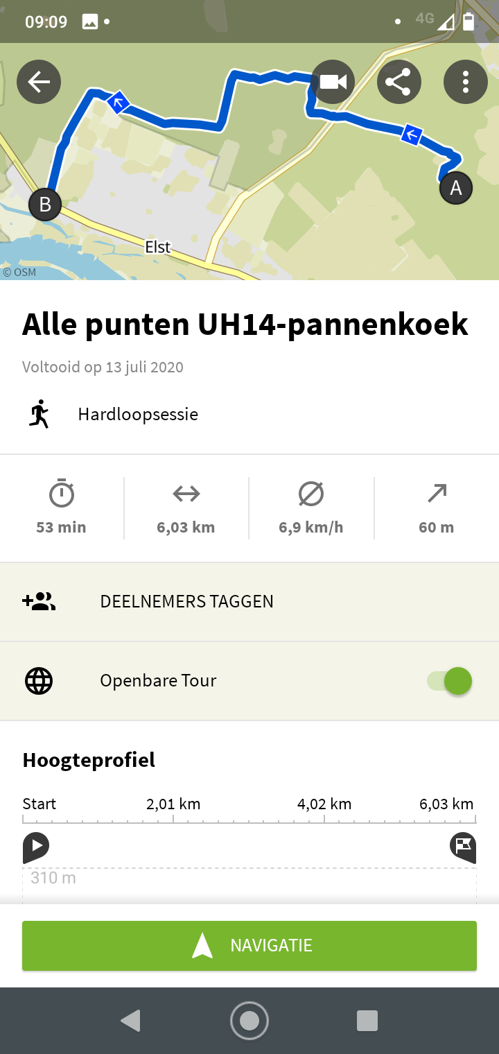
My resulting route had quite a lot of overlapping paths. To remove them, I added as many additional highlights to the route as possible. For example, a path that was marked in Komoot as particularly beautiful, a burial mound, the Leemkuil (loam pit) and a piece of MTB path (Aart Stigter). In this way I was able to draw the lines as far apart as possible,without making the final route too long. A few crossings had to stay for that. As well as a few roads I was less satisfied with, because they were paved. If I really wanted to avoid that at Rhenen, we would have to run many more kilometers. The final route was 55.9 km with 460 altimeters in Komoot. It shifted a bit in Connect (especially in the altimeters: 55.8 km and 680 hm), a sign you have to watch out for. Because both route planners do not have the same maps, it can happen that the route is slightly adjusted. Please also note that Connect is bad at making routes by itself.
Gnome world
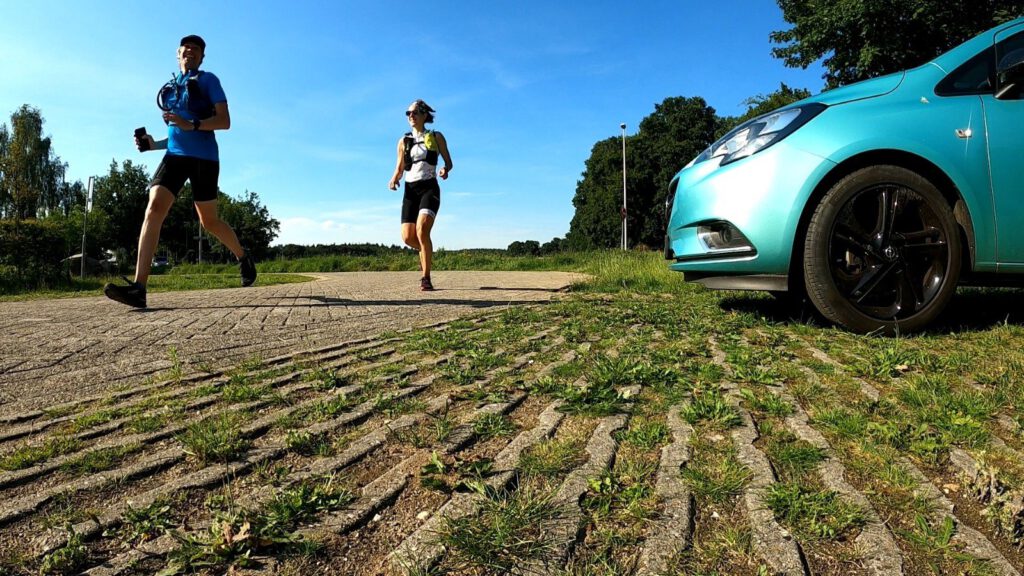
At nine o'clock Simone and I arrived at the pancake restaurant. The weather was predicted to be pretty cool and we were going to run in the woods most of the time. Although Simone still suffered a bit from pain in her Achilles tendon – caused by an ultra on paved road – we felt fresh and started off at a considerate gait.
Soon we ran into a road that we had to track back after about a hundred meters. We realized that we had forgotten something. The road went up; was this one of the hills that was not well defined on the maps? Or was it a mistake by Garmin Connect, which is known for letting you walk back and forth on the same road every now and then for no particular reason? If only we had made Points of Interest of the hill tops... with Suunto I know how to do that, but with the Garmin I hadn't studied it yet. In the end it turned out to be impossible to know why we were walking back and forth.
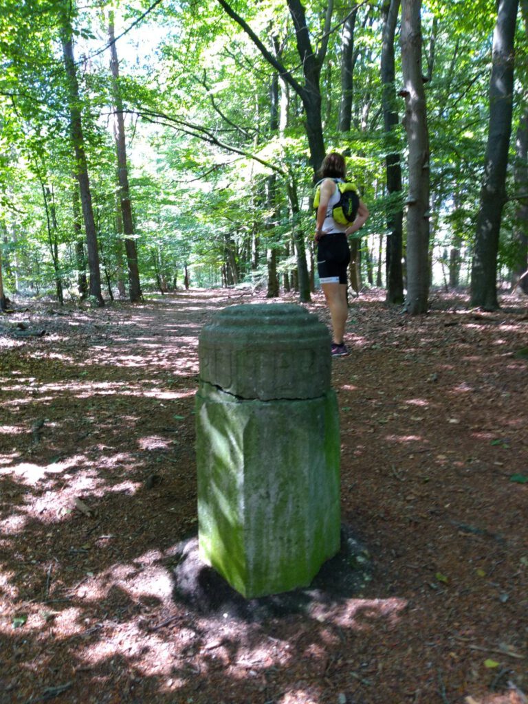
The next time we went back and forth, I already started to apologize. It turned out not to be an accident this time, but a path leading to a burial mound. I willingly admit that I always find that interesting, and had added this one to prevent having to run the same paths twice. The Zuilestein burial mound is especially striking because it is so round and overgrown with grass. It really sticks out of the landscape. Deception: although the hills here are well preserved, the local authority says that the hills have become more visible again after restoration work in the 80s.
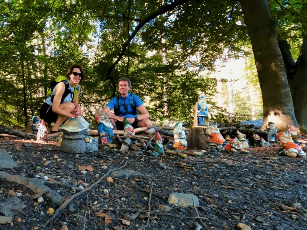
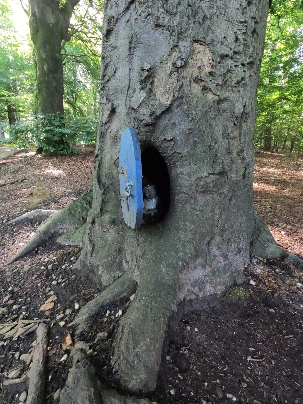
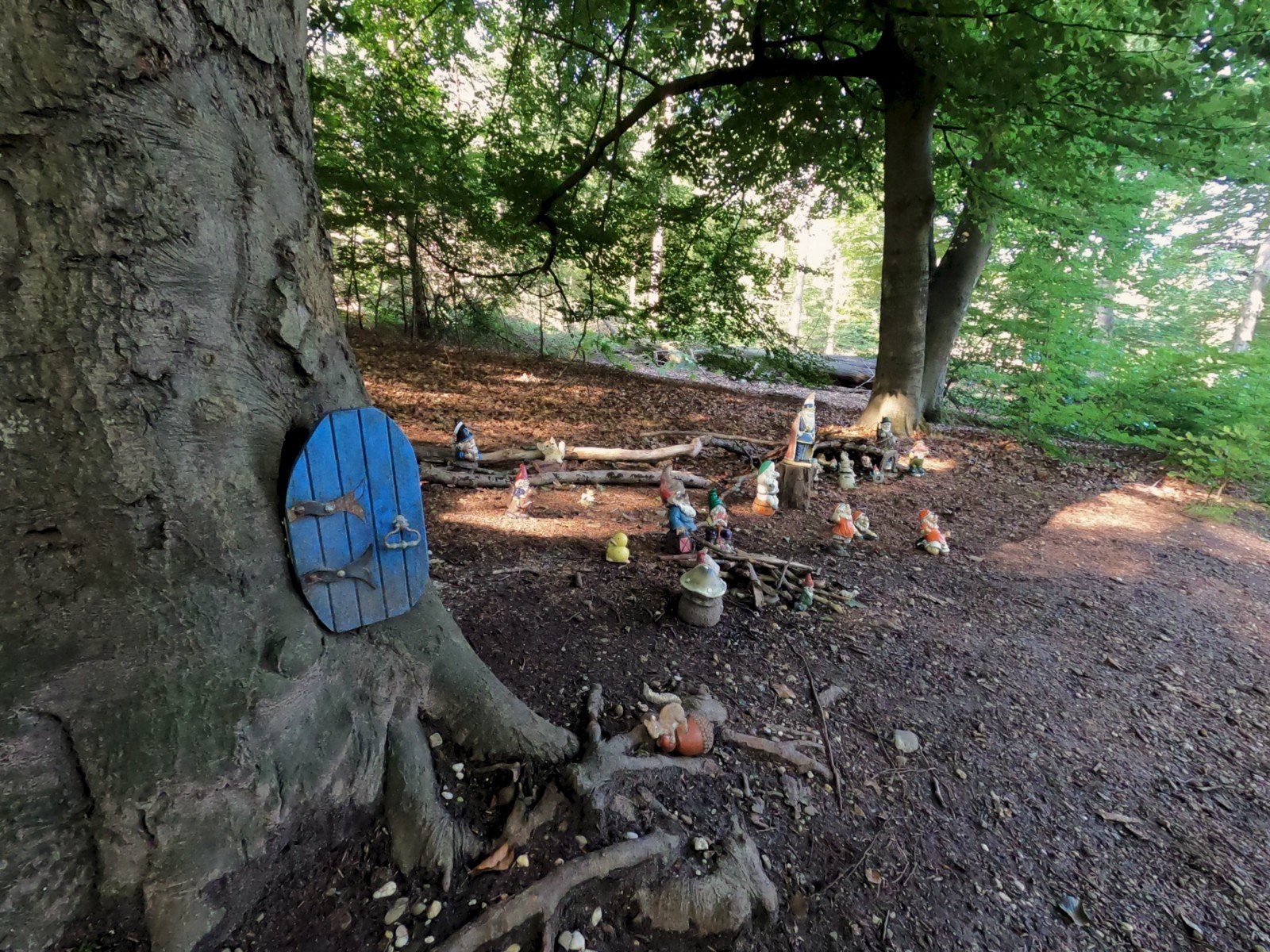
While we slowly began to doubt the recognizability of the hills, we suddenly came across a sign on a slight elevation. It turned out to be the top of the Amerongse Berg. But we could have missed it so easily. This wasn't an imposing mountain that protruded above the landscape, it looked like a hill in a gnome village. It must have been a sign as we also encountered such a village later on.
Retarded elderly
We weren't in a hurry and took our time, while putting in our miles without noticing. We went our way with the greatest ease, sheltered among the trees, without a watch (fixed on navigation screen) or bright sun to dictate the time.
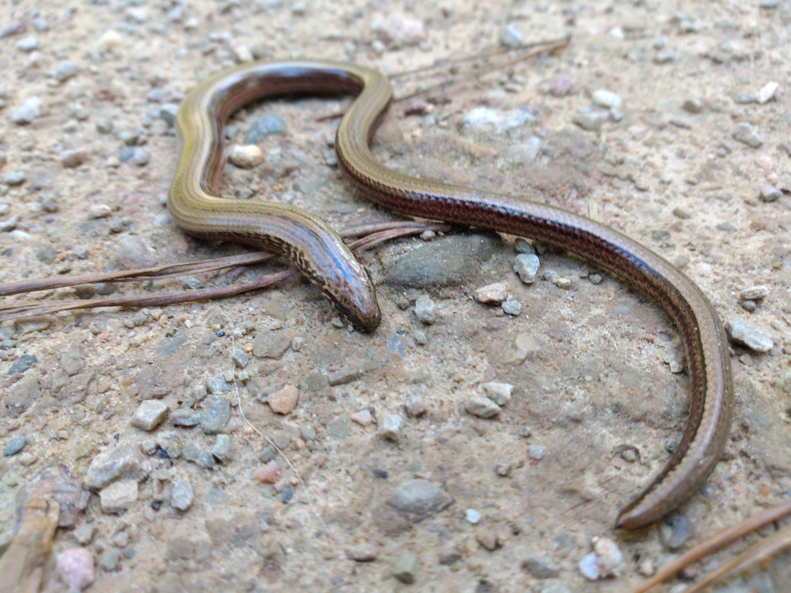
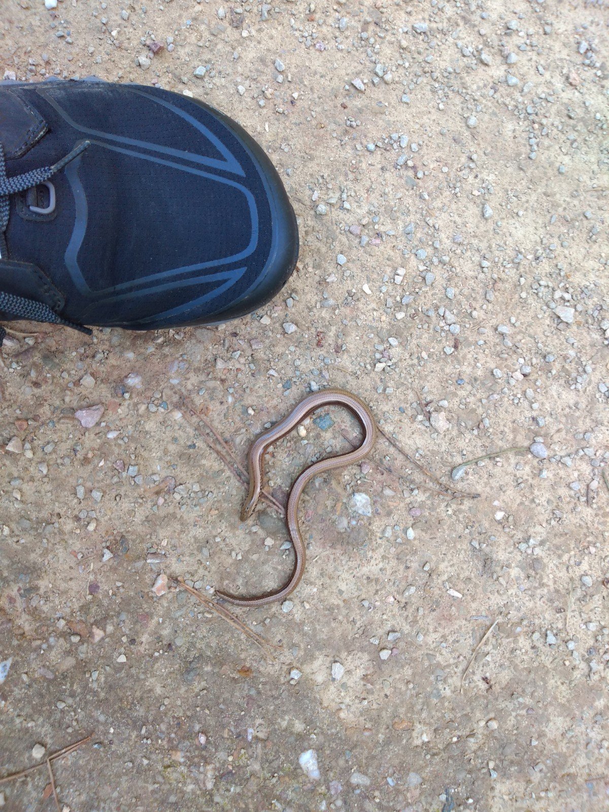
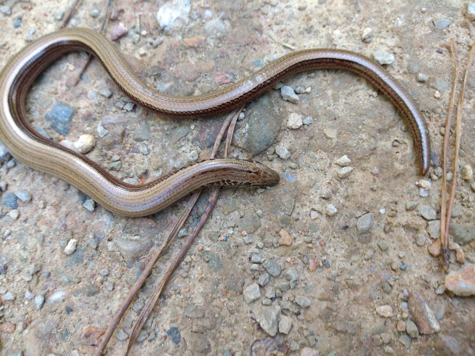
A metallic shimmer on the path made my mind jump back to the GVRAT (Great Virtual Race Across Tennessee). An encounter with a snake is one of the running gags on the Facebook group of the challenge. We don't have that many snakes in the Netherlands and seeing one is very special. But this hazelworm – a lizard, not a snake – is really the second best thing. It was a beautiful creature, with a green-brown shiny skin, waiting for the sun to warm it up. It was motionless; if the reflection of its skin didn't warn you, you would think it was a branch. And I was thrilled to see it. Simone didn't like animals that look like snakes so she remained a little further down the road.
After taking some pictures, I decided we could move on. However, at that moment two elderly people just arrived on electric bikes. I called out, but before our eyes the man drove over the hazelworm, which split in two while convulsing heavily. We stood totally dazed and promptly lost navigation.
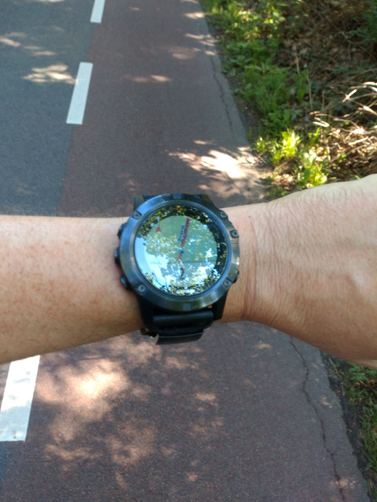
Both Simone's Forerunner 945 and my Fenix 5x told us we were off the path. This was one of those paths we had to walk twice. But we were on the path (my watch 20-30m away from Simone's, but still on the right track). Did we walk this loop to one of the furthest hills in the wrong direction? We went back and tried the other side, because you want to do it ‘neatly according to the route’. Same story. It was striking that our watches didn't seem to measure well either time. Turn-offs in over 6 km were shown one moment and the next only an end point or so many m from the trail flashed the screen. Randomly, it did not matter whether we went a hundred meters in one direction or the other. In the end we just decided to choose left and use our own crumbs to avoid running the same path back.
Again we regretted not having points of interest. Then we could have just kept the order of the hills as guide for the right direction.
Competition area
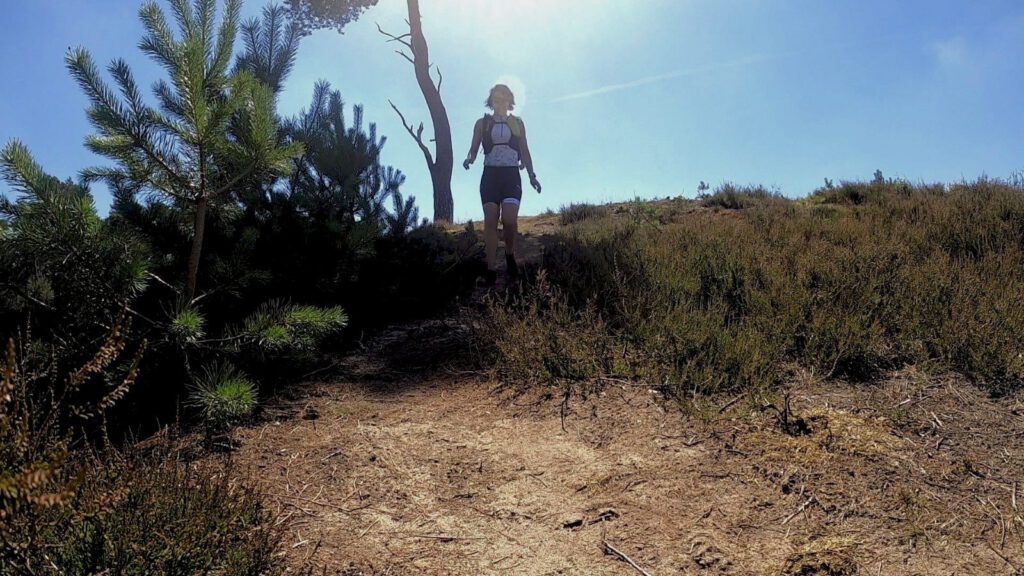

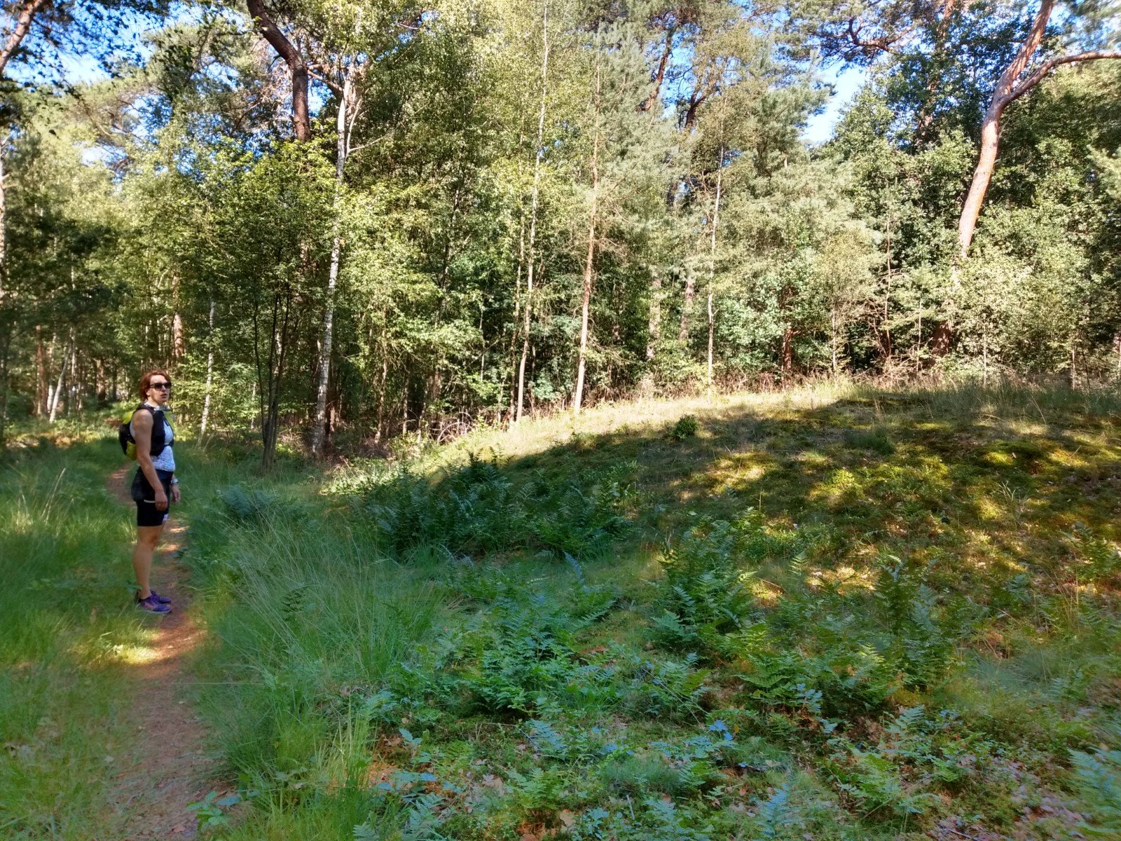
Because we used a relatively narrow strip over the Heuvelrug, the landscape was not extremely varied. However, we did come across a lot of familiar spots from competitions we previously ran alone or together. For example the Lonely Oak (Eenzame Eik) of the Amerongse Berg Trail, the Ginkel Heath of the Airborne Freedom Trail, parts of the NS-MST Utrechtse Heuvelrug. On the one hand it was a pity that we almost didn't go over the heath, but stayed in the forest. On the other hand, a large part of the heathland was inaccessible because of the breeding season (Komoot did warn us about this, but we only had to take a small detour) and it was very hot there.
The straight forest paths made the route a bit predictable, but still we managed to get lost here and there. Again, a part where the route doubled was a problem for the watches. The GPS reception also seemed very inaccurate. Next to each other we didn't always run on the same spot. One time I got a wrong colouring of the map. Twice we reloaded the cards because we thought we were running against the direction of the loop after a double. And sometimes the map did not give the right info after that, so we had to load again to fix the data... It wasn't a device specific problem, both the Fenix 5x and the 945 (with more memory for directions) had these flaws.
Once in a while we could really strangle our watches. You start to doubt yourself when you're looking for a path that doesn't exist or doesn't exist anymore. That happened to us twice on the trail. Another time, over a piece of heathland, there was still a thin path to be seen.
Black screen
The GPS problems were not just irritating, they also caused a large loss of energy. Not only in the watches, but also mentally. Although the body itself still felt very supple, we had just become a bit meeeh. The number of walking breaks gradually increased. But every time we ran again at reasonably high speed shortly after the break.
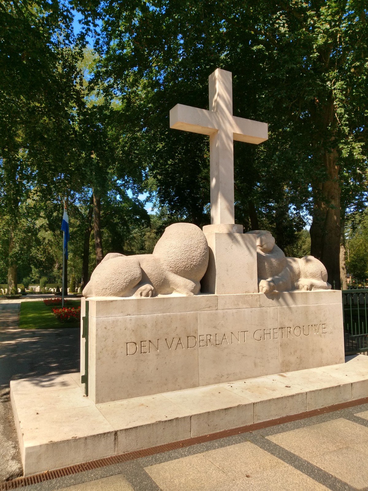
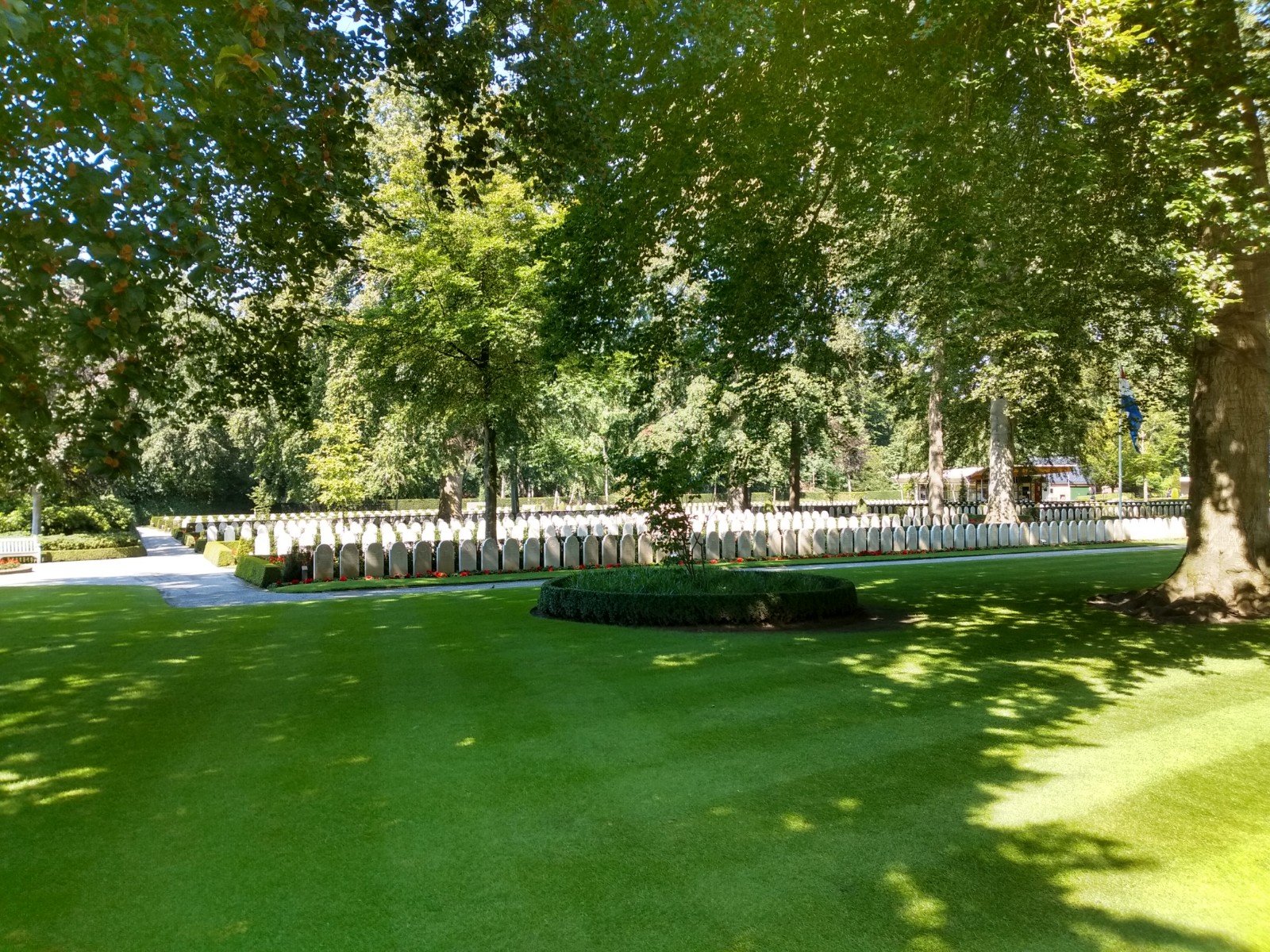
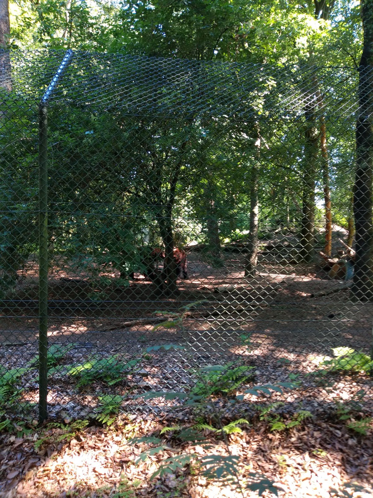
Near Rhenen we also had to run quite a bit over the road and through meadows, in the full sun. At about four o'clock it was still 27 ºC. The fact that the hills were sometimes barely recognizable didn't really motivate us. That detour along the Ouwehands Dierenpark, where we saw bears, was nice though. We were also happy when we passed the monument at the Grebbeberg: we knew we had passed one of the remote corners of our route again.
Because we took it easy and were fooling around with the navigation, we were on our feet for a long time. Simone's watch first dropped out after about 7.5 hours. Mine lasted an hour longer. That's pretty sour on a self supporting tour run on GPS. If only we had brought a power bank with cable... In the end we ran the last 6 km on my phone via Komoot. That went very well, even though it was quite a nuisance to keep that large phone in hand.
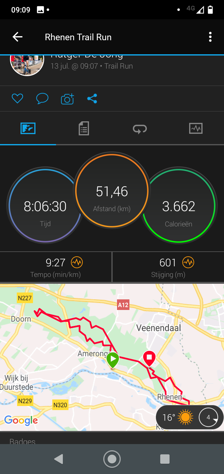
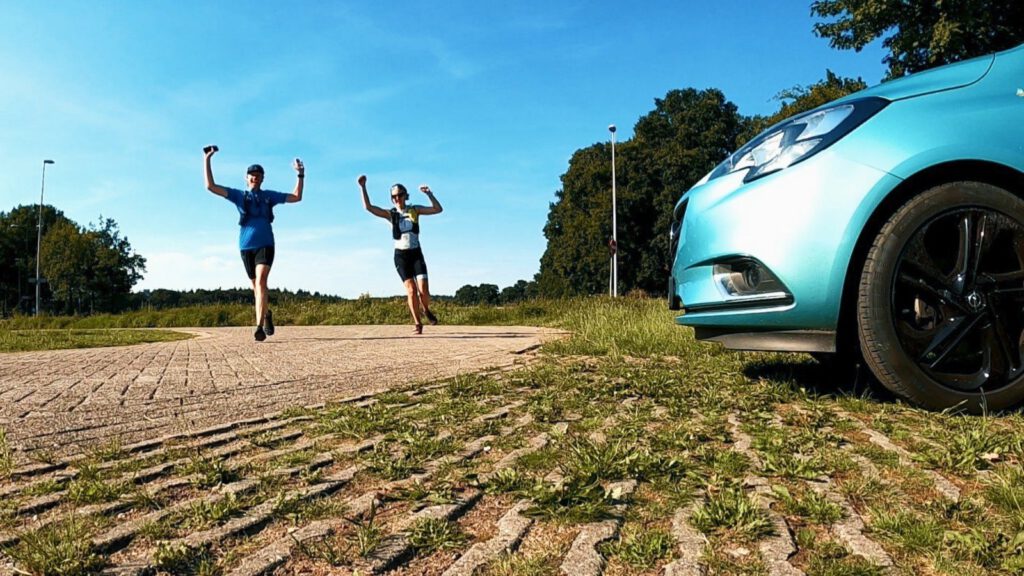
We were so happy when we got back to the car. Of course we made a finish picture for MST and then we went looking for food. The pancake restaurant turned out to be closed on Monday.
Fueling
My diet for this run was not the sober attempt of the previous runs, but a return to the traditional schedule. And that worked pretty well this time. Because we started later, it was nice that I could have breakfast around 7 o'clock (so the insulin had partly ran out when I started running at 9 o'clock). Half an hour before arrival in Amerongen, I took a dose of Generation Ucan. During the run I ate 1.5 Ucan, 1.5 Isostar, 1 gel, half a bag of Powershot cola and three nougat. The blood sugar remained between 5 and 10 mmol/l during the whole run.
In Amerongen Simone and I ambushed Buitenlust, one of the few open restaurants, to replenish our salt supplies. Always amazing that after a day of walking you often have more mental than physical hunger. The extra waiting time by searching for a restaurant did help, as I can't always eat straight away after running.
About the route
It is a nice challenge to plan a route with some waypoints. As mentioned before, it is best to add these points to your watch for recognition. Because they are on a line, I would not recommend the route we ran today as a regular training run where you don't require the 14 points. The variation in nature is simply too small for that. It also led to the fact that there aren't many photos of this run.
Nevertheless, Simone and I had a very relaxing day. It was really TOF (dutch for fun) to do. I don't think either of us suffered from sore legs or feet the next day, which again indicates that it is possible to run almost 60 km without any problems if you do it carefully. People are capable of so much more than they think. In any case, we have more energy than our watches... (Too bad the new Fenix 6 Pro Solar is so unaffordable).
Nicely described weather (sorry, the rest of my week is a bit less relaxed, so I forgot I was going to read your piece before you posted the links). Really... that GPS!!!!! Even my Achilles tendon was hardly irritated, so conclusion: at this extremely relaxed pace you can almost keep walking.
One small correction: my wish not to park in Rhenen had been steered because this was the furthest point in the route from The Hague and I still had to drive the car back after the walk.
I'm sure we'll make another trip like that! Was fun. Thanks for letting me come!
Thank you, will adjust it tonight (regarding Translatepress, because that takes some more work). It's really special that you can run almost forever at that pace, while a fast marathon or long walk often has much more impact on your body. If we are definitely going to do it again, maybe the 11 beach route, then we don't need GPS ; )